Real-Time Highway Conditions Across Nepal
Live road status, landslide alerts, blockage reports, and traffic data — for every major highway.
Real-Time Road Condition Monitoring
Every major highway tracked in real time — know the status before your fleet departs.
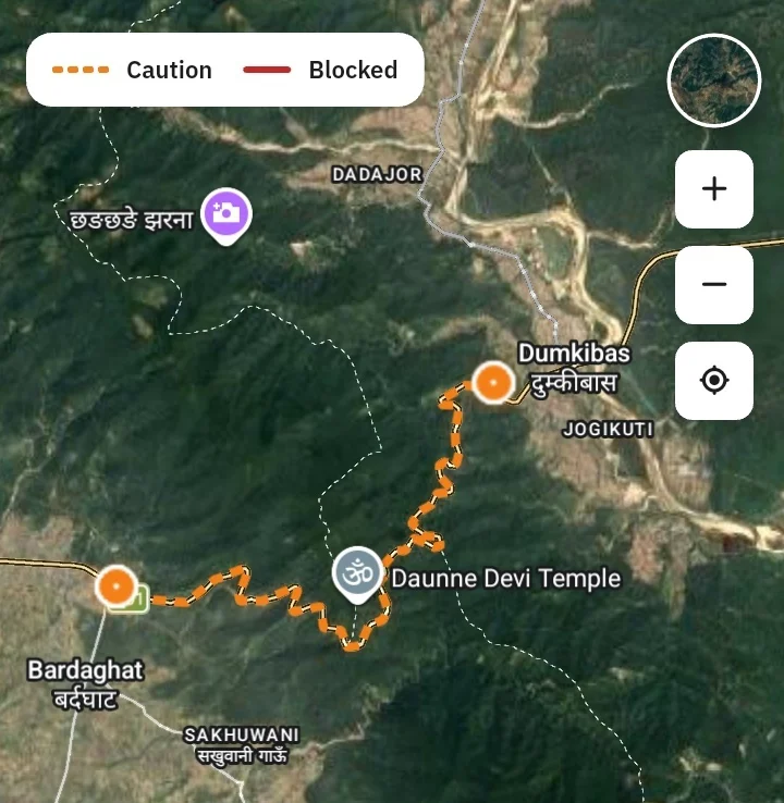
Before a driver enters a blocked route, NepTrack already knows — and the fleet is rerouted before the delay becomes an incident.
Highway Alerts Delivered to Your Fleet in Real Time
Conditions on the route ahead — pushed to every driver and dispatcher automatically.
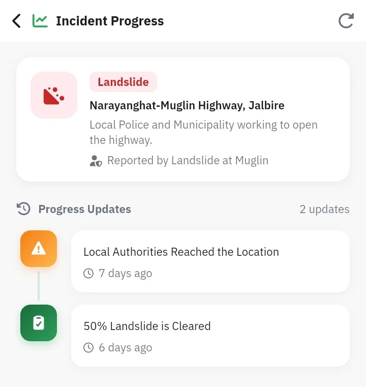
A fleet that knows the road ahead doesn't just save time — it prevents the kind of incidents that cost far more than any delay. Highway intelligence is now part of every NepTrack dispatch.
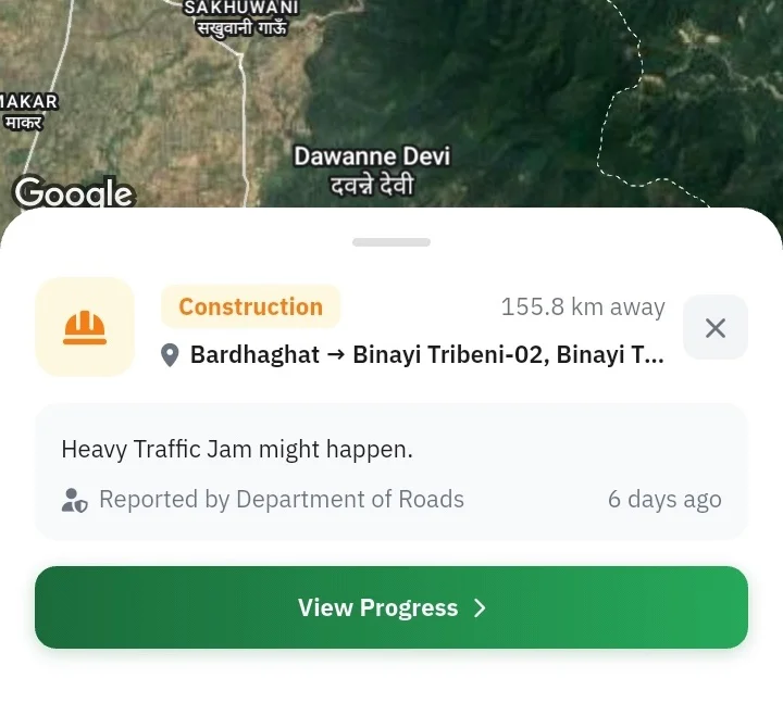
Highway Status Available to Everyone
Open data for travellers, transport operators, and government agencies across Nepal.
What We Monitor and Report
Every type of hazard that can affect Nepal's highways — tracked and reported in real time.
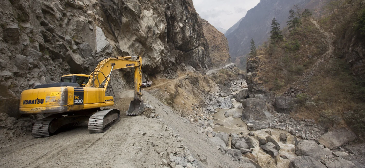
Landslides & Rockfall
Sensor-detected and vehicle-reported landslides and debris on the carriageway
Flooding & Washouts
Monsoon flooding, road washout, and bridge submersion alerts
Road Work & Closures
Scheduled and emergency closures, lane restrictions, and diversions
Low Visibility & Ice
Fog, heavy snow, and icy road conditions on mountain passes
Accidents & Incidents
Vehicle accidents causing obstruction or lane blockage
Traffic Congestion
Heavy traffic, checkpoints, and slow-moving conditions
Bridge Restrictions
Load limits, single-lane operation, and structural advisories
All Clear Updates
Confirmed road reopening and clearance notifications
Nepal's Major Highways
We are expanding coverage across all national and regional highways — prioritised by fleet traffic volume.
Prithvi Highway
Kathmandu to Pokhara — Nepal's busiest commercial corridor for public and private transport.
BP (Araniko) Highway
Kathmandu to Kodari border — high landslide and monsoon closure risk corridor.
Tribhuvan Highway
Kathmandu to Hetauda — mountain highway with frequent fog, landslides, and seasonal closures.
Mahendra Highway (East-West)
Nepal's longest highway stretching across the Terai — critical for freight and public transport.
Narayanghat–Muglin Highway
High-frequency accident zone connecting Chitwan and Pokhara — requires continuous monitoring.
Koshi Highway
Eastern Nepal corridor — high monsoon and flooding risk. Coverage expanding in Phase 2.
Siddhartha Highway
Pokhara to Bhairahawa — mountain descent with regular landslide and congestion events.
Karnali Highway
Remote western Nepal corridor — critical for communities with limited alternate access.
Postal Highway
Southern belt connecting Terai districts — freight-heavy route with seasonal flood risk.